
Mapping out a better future using 'big data'
Imagine a smartphone app that tells you which roads are blocked by fallen trees and floodwaters so you can navigate your way home safely from work after a violent storm.
That’s the sort of future you can expect from the digital marriage of ‘big data’ and traditional mapping.
One of the experts behind Google Earth is helping map a better future for communities across the globe.
World-renowned US environmental scientist and engineer Dr Tim Foresman was in Brisbane in November to establish an exclusive masterclass that will teach the world’s brightest minds how to best integrate spatial information with big data and other information such as smartphone images.
That integration could lead to a raft of new technologies that help communities and governments alike map and respond to critical information in meaningful ways - from birth rates to natural disaster damage.
The masterclass is an initiative of QUT and the Spatial Industries Business Association (SIBA), Australasia’s peak body for the industry, to upskill tomorrow’s industry leaders from around the world.
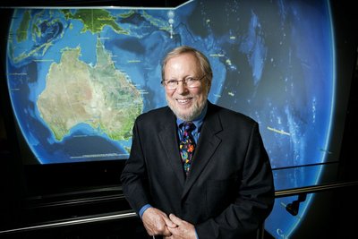
Information modelling specialist Associate Professor Bob Owen, from QUT’s Science and Engineering Faculty, said Dr Foresman was one of the world’s leading experts in spatial information and visualisation systems.
“We are honoured that Tim wants to work with us to build Australia’s capacity to develop and deliver projects that will make a real difference to our lives,” Professor Owen said.
“Tim’s leadership of NASA’s Digital Earth Initiative helped pave the way for Google Earth - a product that has literally changed the way we see, study and navigate our world.
“Tim has written the syllabus for our masterclass and will spend two intensive weeks at QUT next year sharing his knowledge with a select group of promising spatial industry leaders from around the globe.
“I can only imagine what other products will be developed as a result of this masterclass - we’ve only just begun this brave new digital journey.”
Dr Foresman said academic institutes had a responsibility to remake the education experience for today’s students, who will take over the reigns in the spatial digital revolution and make the decisions that impact our lives as citizens and businesses.
“When technology is born and expands worldwide in less than a decade, the challenges for universities likewise expand - but these are much more exciting,” Dr Tim Foresman said.
The QUT and SIBA partnership will propel both organisations into national leadership in spatial information knowledge and technology.
Next year they will showcase pilot projects while world leaders are in Brisbane for the G20 Summit.
One of those big data integration projects could see the public help build near-real-time maps of damage from natural disasters simply by taking photographs and sending them to emergency services.
Richard Simpson, CEO of SIBA Queensland, says the projects will demonstrate the phenomenal shift from traditional surveying and map-making.
“The shift to big data has exciting ramifications for the spatial industry, which is growing at breakneck pace.
“The new paradigm will blur our physical and digital worlds, redefine our identity with places and open an extraordinary opportunity for building a world-leading knowledge economy,” Simpson said.
The Spatial Information International Master Class will take place at QUT in mid-2014.
Contract labour in mining: do savings outweigh safety outcomes?
Australian researchers have analysed decades of research on contract labour in mining, arguing...
Psychosocial risk management: eight trends with tips
Psychosocial risk management has become a central pillar of workplace safety and organisational...
50 in 2024: Victoria's workplace fatalities figures
Transport, construction and agriculture were Victoria's deadliest sectors in 2024, with...


